Canada’s weather is dramatic by design — but every so often, it throws such a tantrum that even the best apps, forecasts, and radar tools freeze, glitch, or shrug in defeat. These aren’t exaggerations. These are real, timestamped moments when storms, heatwaves, and cold snaps pushed our systems (and our patience) past the brink. From ice storms that erased power grids to temperature swings that felt digitally impossible, these 21 weather meltdowns broke our apps and patience.
The Eastern Canadian Blizzard That Buried Montreal (March 3–5, 1971)
The blizzard of March 1971 remains one of Montreal’s most infamous weather meltdowns, a storm so intense it overwhelmed every form of communication. Snow fell at such a relentless pace that visibility dropped to near-zero for hours, wind gusts reached 110 km/h, and over 40 cm of snow piled up in a single day. Even government weather services struggled to update alerts fast enough. Transit stopped, power flickered across the city, and phones jammed with calls. It was the kind of storm that made apps feel meaningless long before apps even existed.
The 1998 Ice Storm That Crushed the Grid (January 4–10, 1998)
The January 1998 ice storm remains one of the most devastating weather events in Canadian history. For six days straight, freezing rain coated everything in thick layers of ice — trees, power lines, highways, and entire neighbourhoods. Over 100 mm of freezing rain fell in parts of Quebec and Eastern Ontario, snapping hydro towers like matchsticks and leaving more than 3 million people without power. Modern weather services were overwhelmed, struggling to keep up with the rapidly growing damage. Even decades later, no app could adequately describe what it felt like: a frozen world, dark for days, running on community resilience and sheer grit.
The Edmonton Tornado That Came Out of Nowhere (July 31, 1987)
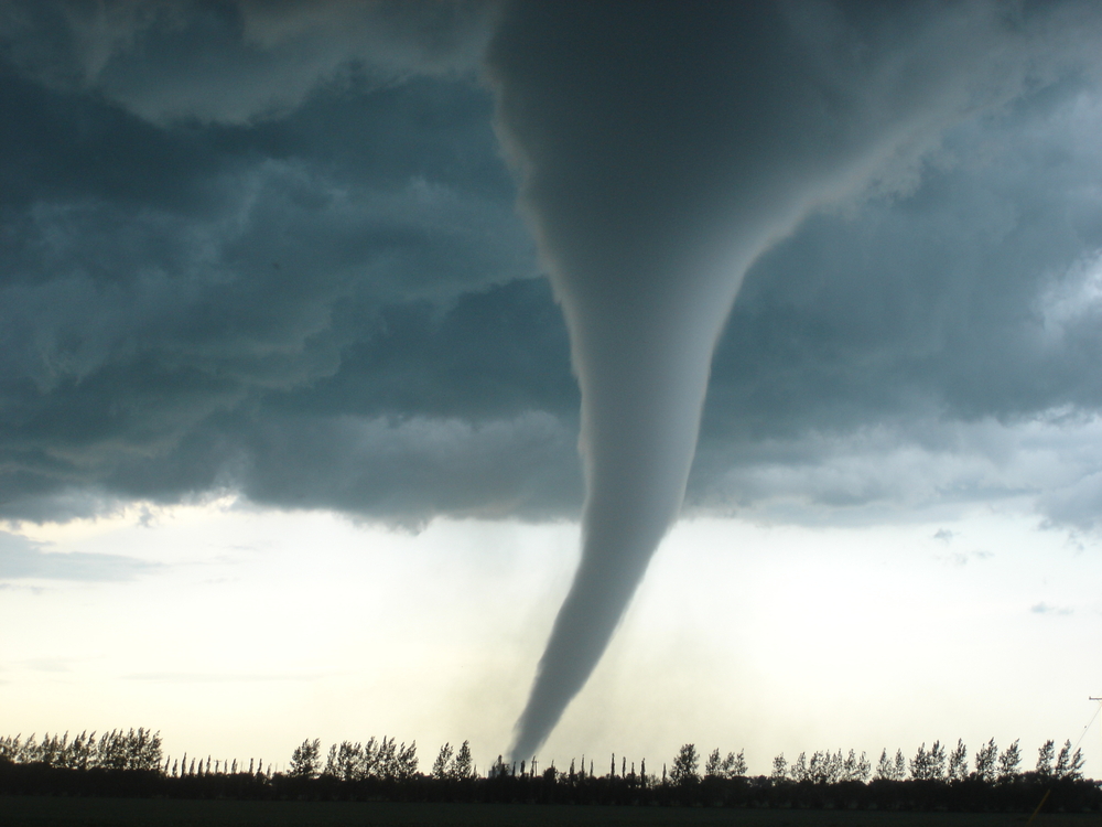
Known as “Black Friday,” the Edmonton tornado tore through the city with little warning on July 31, 1987. The storm intensified so fast that early radar systems struggled to capture its true strength. Classified as an F4 tornado, it carved a deadly path through neighbourhoods, industrial sites, and highways. Winds reached an estimated 420 km/h. Powerlines snapped, phones jammed, and broadcast systems overloaded as updates lagged behind the tornado’s furious pace. It was one of the clearest examples of Canadian weather outrunning Canadian technology — and one that remains etched in Alberta’s memory.
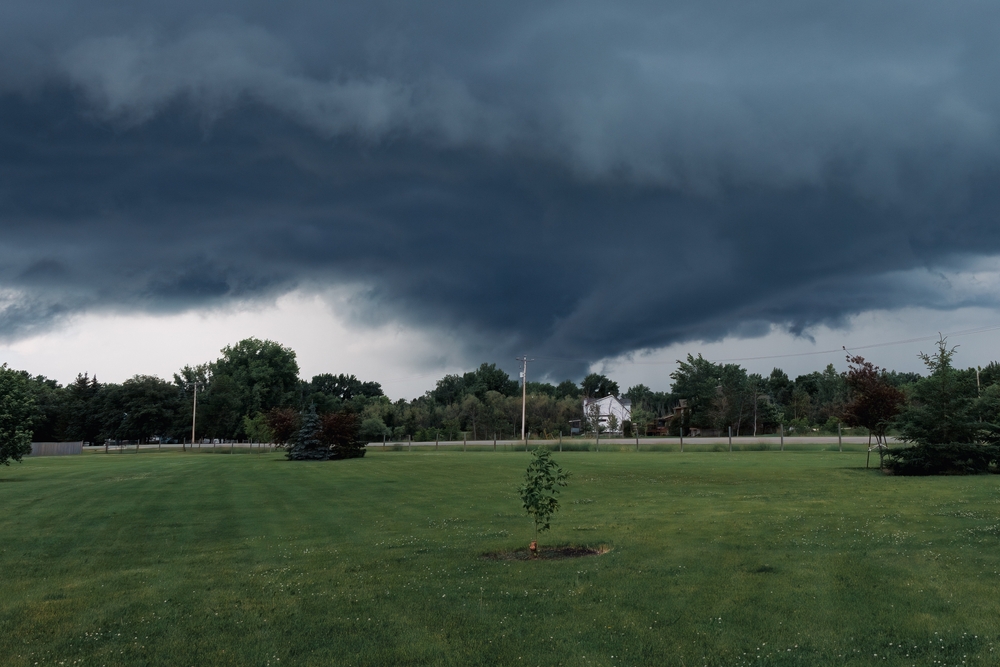
The Derecho That Flattened Half of Ontario (May 21, 2022)

On May 21, 2022, a rare derecho thundered across Ontario and Quebec, packing winds over 120 km/h and leaving entire regions without power. The storm moved so rapidly — and violently — that weather apps couldn’t keep up. Many people received alerts only after the damage was already happening. Trees toppled across highways, cell service flickered out, and transformer explosions lit up neighbourhoods. The system moved more like a hurricane than a thunderstorm, transforming a sunny long weekend into a province-wide scramble. For many Canadians, this was the moment they realized weather apps aren’t built for everything.
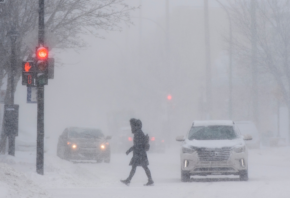
The Monster Winter Storm That Shut Down Ontario (January 14–17, 2022)
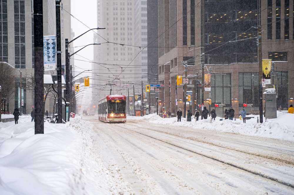
The mid-January 2022 storm was a snow event so aggressive that even seasoned Ontario residents were stunned. Over 50 cm fell in the GTA alone, with winds trapping cars on major highways and burying neighbourhoods faster than plows could respond. Forecasts lagged, radar maps froze, and travelers found themselves staring at screens offering no useful updates. Public transit stalled in Toronto, schools closed across the province, and emergency crews had to rescue stranded drivers. It was one of those moments when apps said “10–15 cm,” but the sky delivered a full-scale winter shutdown instead.
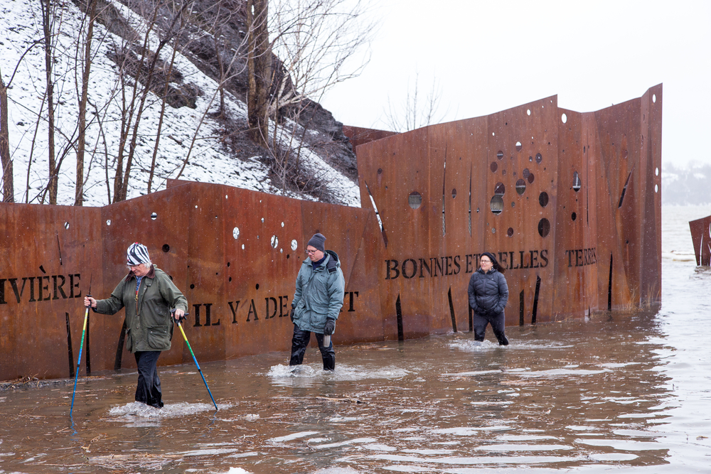
The 2019 Floods That Turned Streets Into Rivers (April–June 2019)
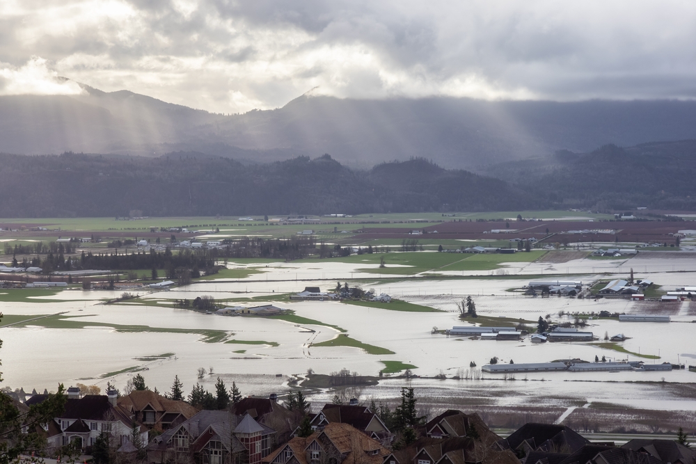
In spring 2019, heavy rain and snowmelt combined to create historic flooding across Quebec, Ontario, and New Brunswick. Rivers spilled their banks for weeks, and water levels rose so unpredictably that forecasts were outdated within hours. Apps struggled to map new flood zones fast enough. Homes were evacuated, highways were closed, and sandbag lines stretched for kilometres. It wasn’t a single event — it was a rolling, weeks-long crisis where weather updates never caught up to reality. For many Canadians, it was a harsh reminder that water doesn’t care about timelines, alerts, or algorithms.
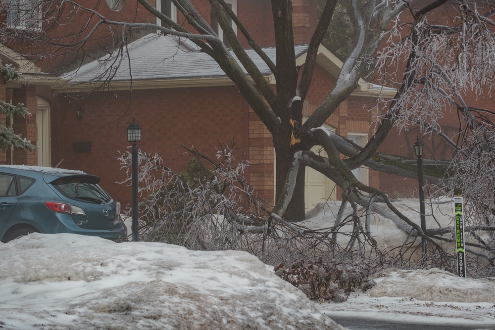
The Ice Storm That Knocked Out Metro Montreal (April 5–6, 2023)
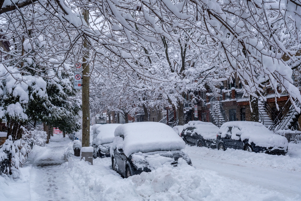
The April 2023 ice storm brought back memories of 1998, coating Montreal and surrounding areas in heavy layers of freezing rain. Over 1 million people lost power, trees crashed onto roads, and transformers blew across the skyline. Apps initially predicted “mixed precipitation,” but the storm intensified rapidly, overwhelming the city. Roads became skating rinks, traffic lights went dark, and the outages took days to restore. It was one of the clearest modern examples of how fast freezing rain can escalate, turning mild forecasts into city-wide breakdowns.
The Humidity Wave That Made Atlantic Canada Feel Tropical (June 18–20, 2024)
In June 2024, Atlantic Canada experienced a heat-humidity combination so intense it felt like the region was temporarily teleported to the tropics. With humidex values surpassing 40, weather apps struggled to measure and adjust fast enough. Some readings contradicted one another; others jumped from moderate to extreme within minutes. Power demand soared, air-quality alerts stacked up, and outdoor events were cancelled. It was a reminder that extreme heat isn’t just a Western Canada issue — the East can melt just as fiercely, and even the smartest forecasting models struggled to keep pace.
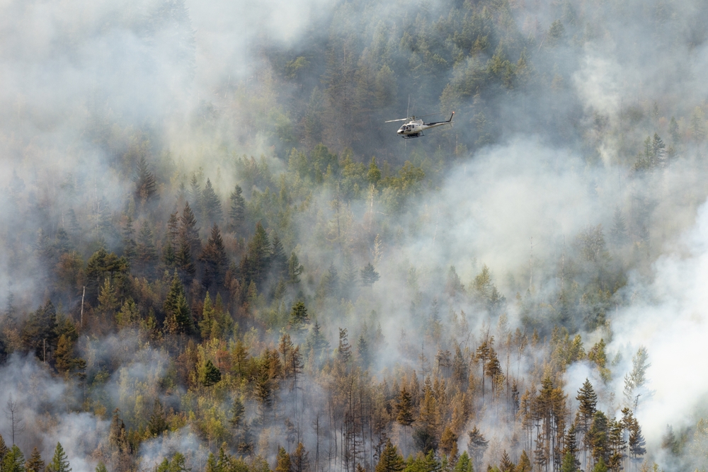
The Fort McMurray Wildfire Evacuation (May 1–Early May 2016)
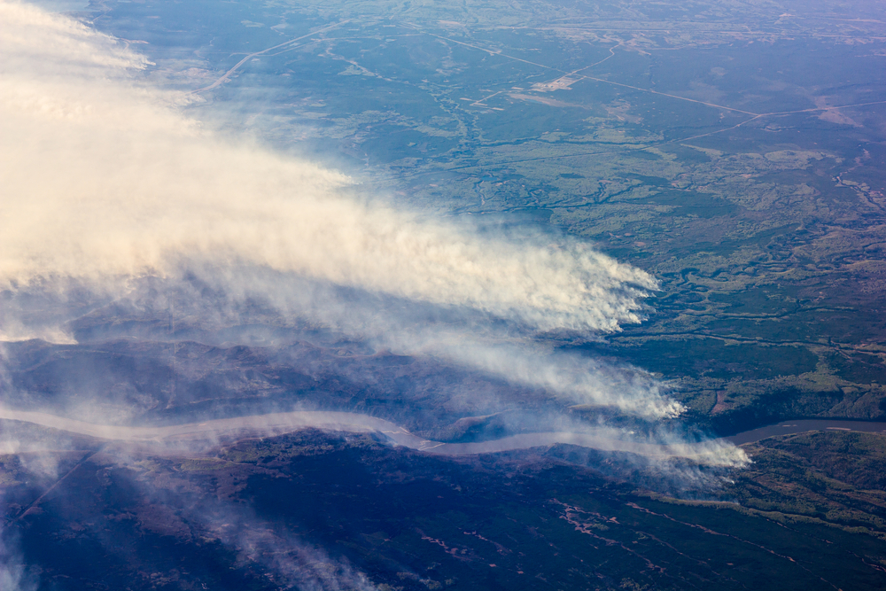
When the Fort McMurray wildfire exploded on May 1, 2016, weather conditions shifted so quickly that forecasts became almost unusable. Hot, dry air and strong winds turned a manageable fire into an inferno in hours. Smoke plumes overwhelmed satellite imagery, GPS signals faltered, and road conditions changed faster than apps could refresh. Nearly 90,000 residents were forced to evacuate with little information besides what they could see with their own eyes. It was one of the most dramatic examples of weather-driven chaos Canada has ever witnessed — and a stark lesson in how fire outpaces technology.
The 2025 Prairie Wildfire Season That Overloaded Alerts (May–June 2025)
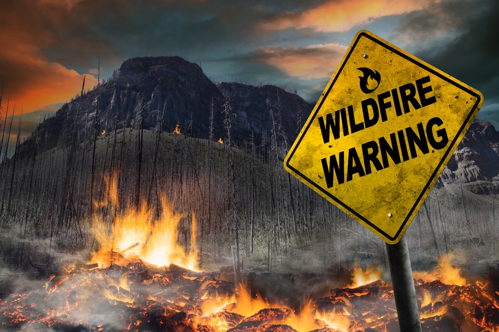
In spring 2025, intense fires across Manitoba, Saskatchewan, and Alberta triggered some of the largest evacuation zones seen in years. Wind direction changed by the hour, making smoke maps glitch, reroute, or freeze entirely. Emergency alerts stacked on top of each other, some delayed, others duplicating. Air-quality indexes hit levels too high for apps to categorize cleanly. For many Prairie residents, this season was the moment they realized digital tools weren’t designed for fire seasons that behave like fast-moving storms. The apps simply couldn’t keep up — and neither could anyone else.
The Remnants of Hurricane Debby That Flooded Quebec (August 9, 2024)
On August 9, 2024, the remnants of Hurricane Debby swept into Quebec and Ontario with a fury that apps underestimated until the last minute. Rain fell in torrential bursts, highways flooded, and transit systems stalled as drains overflowed. The storm wasn’t supposed to hit this hard inland — but warm waters supercharged it. Radar maps struggled to track their rapidly shifting rain bands, leading to sudden warnings and missed notifications. It was one of those chaotic summer systems that remind Canadians that tropical weather doesn’t respect distance or prediction models.
The Tornado Outbreak Hidden Inside the 2022 Derecho (May 21, 2022)
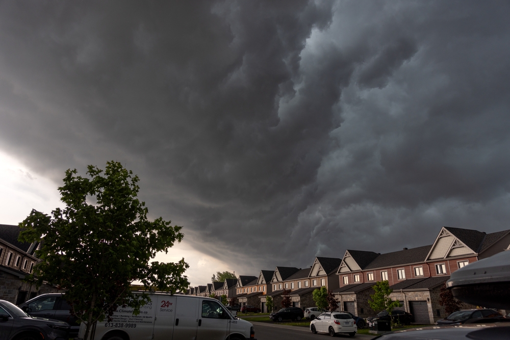
While the 2022 derecho stole the headlines, several tornadoes touched down that same day across Southern Ontario — including a destructive one in Uxbridge. The storm system moved so fast that apps couldn’t distinguish straight-line winds from tornadic rotation in real time. Some residents got warnings minutes after the tornado had already hit. Trees snapped like twigs, rooftops peeled away, and debris scattered across neighbourhoods. What made this meltdown particularly frustrating was how quickly conditions shifted from “windy” to “violent.” Even advanced radar struggled, leaving thousands relying on visual cues rather than digital alerts. It was a day when apps lagged and nature set the tempo.
The 2014 Polar Vortex That Froze Eastern Canada Solid (February 2014)

In February 2014, the cold wave known as the Polar Vortex plunged much of Eastern and Central Canada into temperatures colder than parts of Mars. Wind chills reached below –40, pipes burst, transit systems seized up, and weather apps became a parade of extreme cold warnings. Forecasts are updated so frequently that people couldn’t tell which alert was current. The cold disrupted cellular towers, froze car batteries by the thousands, and stalled airports across the region. It was one of those rare events where everyone asked the same question: “Is this even real?” The apps said yes — but barely kept up.
The Surprise F5 Tornado in Manitoba (June 22, 2007)
The Elie, Manitoba, tornado — Canada’s first confirmed F5 — struck on June 22, 2007, and caught residents off guard because it intensified at a speed rarely seen on the Prairies. Radar registered a storm, but its leap to F5 strength happened so quickly that digital warnings lagged behind reality. Winds exceeded 420 km/h as the tornado destroyed homes and tossed vehicles into fields. It was a chilling example of Canadian weather evolving faster than monitoring tools could track. The event shocked experts and highlighted how even the best systems sometimes struggle with rare, explosive storms.
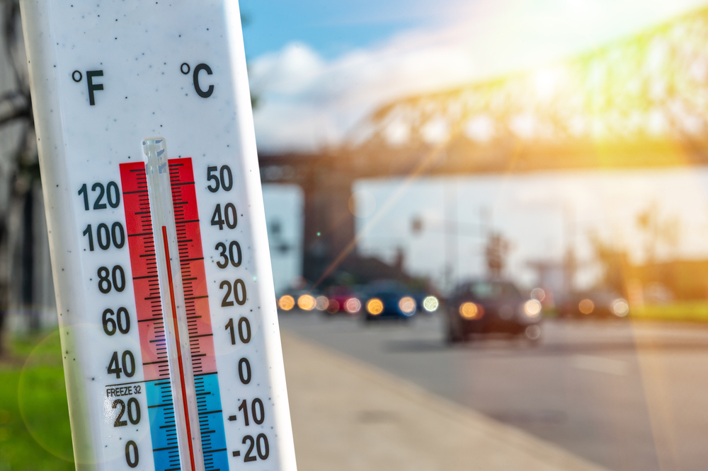
The Pacific Northwest Heatwave That Buckled the West (June 2021)

Late June 2021 delivered temperatures Western Canada had never recorded. Lytton reached 49.6°C — the hottest temperature in Canadian history — overwhelming every forecasting model. Apps kept revising highs upward until they seemed unbelievable. Roads buckled, power grids strained, and cooling centres overflowed. Some apps even glitched, unable to display three-digit humidex values properly. The scale of the heatwave left millions navigating unprecedented conditions with tools not built for this level of extreme. It was a moment that redefined the upper limits of “Canadian summer.”
The Ghost, Alberta Temperature Crash (January 31–February 1, 1989)

This dramatic cold snap saw temperatures in Ghost, Alberta, plunge by nearly 30 degrees overnight — a meteorological drop so abrupt that early forecasting tools couldn’t keep up. Local readings plummeted below –40, and wind chills sank even lower. The sudden freeze caused ice fog, stalled vehicles, and frozen infrastructure across communities. Apps are better now, but even today, rapid temperature swings confuse systems. This event remains one of Canada’s sharpest reminders that weather here can pivot with astonishing speed, leaving technology scrambling to translate the chaos.
The Tatla Lake Temperature Whiplash (January 5, 1982)
Tatla Lake, BC, witnessed a temperature jump so dramatic that it became one of Canada’s most famous short-term weather anomalies. A warm chinook-like surge blasted through the region on January 5, 1982, spiking readings by more than 25 degrees in a single day. Forecasting tools weren’t prepared for the speed of the shift, and alerts lagged behind the real-time rise. Residents went from layering up for extreme cold to dealing with melting snow and slush within hours. It was a rare case of warm-weather chaos in deep winter — and proof that sudden heat can break apps just as easily as sudden cold.
The St. Lawrence River Drought Low (October 18, 2025)
By October 2025, drought conditions pushed the St. Lawrence River to some of its lowest recorded levels. The drop exposed riverbanks, disrupted shipping lanes, and confused navigation apps designed for stable water data. Forecasts underestimated how quickly the levels would fall, and rainfall models repeatedly missed the mark. Barges slowed, ports struggled, and communities along the shoreline dealt with shifting shorelines that maps couldn’t accurately display. It was a reminder that water shortages — not just storms — are capable of breaking digital systems built on historical norms.
The Summer 2023 Wildfire Smoke That Blotted Out Half the Country
Summer 2023 became Canada’s largest wildfire season on record, with smoke drifting across provinces, shutting down outdoor events, and turning skies orange. Air-quality apps went haywire — some showing “hazardous,” others displaying blank spaces because the data exceeded measurable ranges. Flights were delayed, highways closed, and cities across Ontario, Quebec, and the Prairies woke up to apocalyptic haze. The scale of the smoke overwhelmed both sensors and software. It was the first time many Canadians saw AQI numbers above 400 — levels so extreme that most apps weren’t programmed to interpret them.
The Calgary Hailstorm That Rewrote Insurance Books (2024)
Calgary is no stranger to hail, but the 2024 storm hammered neighbourhoods with ice stones big enough to crack windshields and perforate siding. Radar struggled to capture the severity because the hail cores were so dense they distorted readings. Apps predicted “severe thunderstorms” but drastically underestimated the destructive potential. Cars were totaled, skylights shattered, and streets looked like they had been hit by a violent ice barrage. The aftermath caused insurance claims to skyrocket, making it one of the city’s most expensive hail events — and one of the clearest examples of apps missing the mark.
The Atlantic Heat Burst That Confused Every Forecast (June 2024)
In June 2024, Atlantic Canada experienced a rare night-time heat burst — a sudden spike in temperature driven by descending warm, dry air. Temperatures jumped dramatically in minutes, leaving weather apps scrambling to update. Many residents watched their readings surge from the low 20s to the mid-30s before midnight. Humidity plummeted, winds shifted, and forecasts looked broken as models failed to account for the anomaly. It lasted only hours, but it was enough to break trust in summer weather predictions. It felt like a glitch in the atmosphere — except it was entirely real.
21 Products Canadians Should Stockpile Before Tariffs Hit

If trade tensions escalate between Canada and the U.S., everyday essentials can suddenly disappear or skyrocket in price. Products like pantry basics and tech must-haves that depend on are deeply tied to cross-border supply chains and are likely to face various kinds of disruptions
21 Products Canadians Should Stockpile Before Tariffs Hit