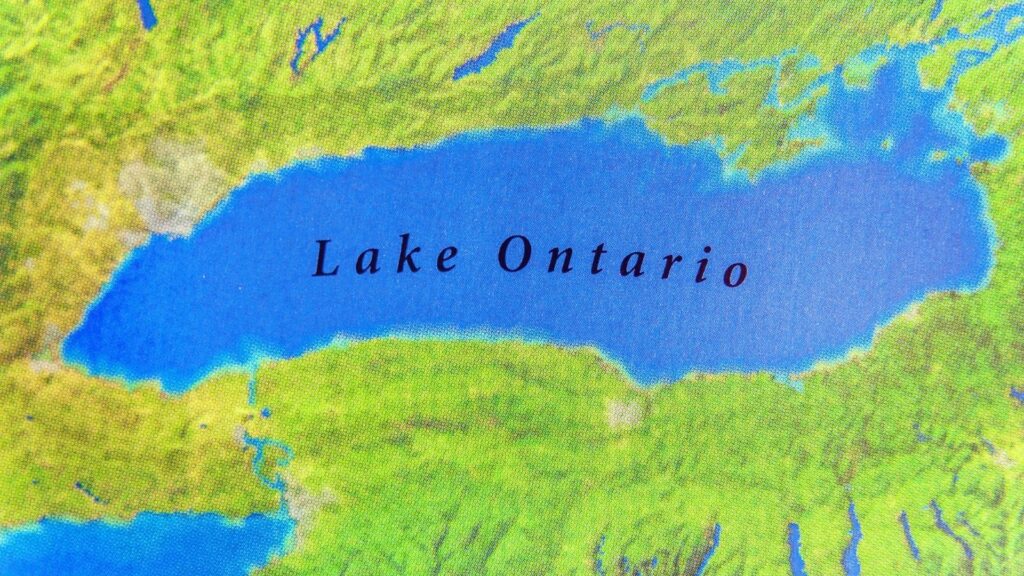
A familiar stretch of blue on Google Maps now carries a very different name depending on which side of the Canada-U.S. border is looking at it. Google has begun displaying Lake Ontario as “Lake America” for users in the United States, after President Donald Trump ordered the centuries-old name changed for U.S. federal purposes.
The shift is far more than a cosmetic map update. Canadians continue to see Lake Ontario, while Google says people outside Canada and the United States will see both names. The unusual split has turned one of North America’s five Great Lakes into another flashpoint in an increasingly tense relationship between Ottawa and Washington, combining technology, Indigenous history, geography and an escalating trade fight in a dispute now playing out directly on millions of screens.
Google Maps Has Already Started Showing the New Name
Google confirmed on August 29 that its Maps service was beginning to display “Lake America” to people using the platform in the United States. The company said the change followed an update to the U.S. Geographic Names Information System, or GNIS, the federal database that serves as the authoritative source for geographic names used by U.S. government agencies. By August 30, checks by major news organizations showed the new label appearing on both mobile and desktop versions of Google Maps in the United States.
The experience is deliberately different across borders. Canadian users will continue seeing “Lake Ontario,” according to Google, while people outside Canada and the United States will be shown both names. That means two people looking at exactly the same body of water can now encounter different labels depending on where Google determines they are located. The lake itself, stretching between Ontario and New York, has not changed; the digital representation of its identity has.
Trump’s Order Changed the Name for U.S. Federal Use
President Trump signed the executive order on August 27, directing the Secretary of the Interior and the U.S. Board on Geographic Names to rename Lake Ontario “Lake America.” The order instructed federal officials to update GNIS and ensure that executive departments and agencies use the new designation on government maps, contracts, documents and communications. Although the order allowed up to 30 days for implementation, federal geographic systems moved considerably faster.
The U.S. Geological Survey subsequently began applying the new terminology to its own operations. Its publications database now states that new USGS publications will use “Lake America,” while older publications will retain the geographic name in use when they were originally produced. That distinction illustrates what Trump’s directive immediately controls: federal nomenclature. It standardizes what American federal institutions call the lake going forward, rather than retroactively rewriting every historic document in which “Lake Ontario” appears.
Google Says It Is Following an Existing Maps Policy
Google has framed its decision as an application of an established mapping rule rather than an independent endorsement of Trump’s preferred name. The company says it updates geographic labels when authoritative government sources change and has long displayed different names for bodies of water when governments disagree over terminology. Once GNIS formally reflected “Lake America,” Google said its U.S. version of Maps would follow that source.
There is a recent precedent. After the U.S. government changed the federal designation of the Gulf of Mexico to the “Gulf of America” in 2025, Google showed the new name to U.S. users, retained “Gulf of Mexico” for Mexican users and displayed both elsewhere. Google has also explained that country-specific Maps views can be determined through information such as a mobile device’s operating system, SIM, network and locale. On the web, selected search-region settings or device location can affect which geographic terminology appears.
Canada Is Keeping Lake Ontario — and Its Leaders Are Making That Clear
Canada has rejected Washington’s attempt to replace the existing name. Prime Minister Mark Carney responded shortly after Trump signed the order by emphasizing that Lake Ontario’s name predates both Canadian Confederation and the founding of the United States. His government has made no move to alter Canada’s official terminology, meaning Canadian government maps, documents and geographic databases continue referring to the lake by its traditional name.
Ontario Premier Doug Ford turned that disagreement into a highly visible response. A billboard-sized bilingual sign declaring “Lake Ontario. Now and Always” was installed near Grimsby, Ontario, overlooking the lake. The dispute has also drawn criticism from Indigenous leaders. Representatives of the Wendat and Wyandotte peoples argued that removing the Ontario name disregards the Indigenous linguistic history from which it developed. The result is an unusual diplomatic dispute in which roadside signage, government databases and digital maps are all communicating competing versions of the same geographic identity.
The Name “Ontario” Has Indigenous Roots Going Back Centuries
The controversy is particularly sensitive because “Ontario” was not originally a modern Canadian political label imposed on the lake. Government and historical sources trace the name to Indigenous Iroquoian languages. The Ontario government describes it as coming from a word meaning “beautiful lake” or “beautiful water,” while Wendat sources connect it with Ontari’io. Versions of the Ontario name were being applied to the lake centuries before Canada became a country in 1867.
The physical geography also underscores why the naming issue cannot be viewed solely as an American domestic matter. Lake Ontario is the smallest of the five Great Lakes by surface area, covering about 18,960 square kilometres. It is bordered by the province of Ontario and New York State, with the international boundary running through the lake. Canadian government data list an average depth of about 86 metres and a maximum depth of roughly 244 metres. Water entering through the Niagara River ultimately exits toward the Atlantic through the St. Lawrence River, making the lake part of a deeply interconnected binational system.
The Executive Order Does Not Rename the Lake for Canada
The U.S. Board on Geographic Names exists primarily to standardize geographic terminology across the American federal government. Its decisions determine names used by federal departments and official U.S. geographic databases, but the U.S. Geological Survey explicitly notes that federal naming authorities do not control how private companies or other organizations update their own map products. That distinction is precisely why Google can adopt “Lake America” while another mapping company can decline to do so.
Nor does Washington’s new terminology erase the international nature of Lake Ontario. Canada’s federal mapping system continues to show the international boundary crossing the lake between Ontario and New York. The two countries have managed their shared waters under the 1909 Boundary Waters Treaty for more than a century, with the International Joint Commission helping oversee issues involving water levels, flows and environmental cooperation. Nothing in Trump’s naming order purports to relocate that border or replace the binational treaty structure. In practical legal and geographic terms, changing an American federal label is very different from changing sovereignty over the water.
Apple and MapQuest Have Not Followed Google’s Lead
The response from the technology industry also shows that the U.S. government’s designation does not automatically dictate what every private map must display. An Axios comparison on August 30 found that while Google Maps was showing “Lake America” in the United States, Apple Maps was still displaying Lake Ontario. Apple’s position could change, particularly because it adopted the U.S. government’s “Gulf of America” terminology previously, but as of the latest checks the two major platforms were showing different names.
MapQuest has taken an even clearer position. The veteran online mapping company publicly announced that it would not change Lake Ontario’s name and used the controversy to revive attention around its service. That creates a striking modern cartographic situation: the same American user can open one mapping platform and see “Lake America,” then open another and see “Lake Ontario.” USGS guidance makes clear that such differences are possible because private companies remain responsible for how they use and display federal geographic-name data.
The Map Fight Is Happening in the Middle of a Much Bigger Trade War
The timing of Trump’s executive order is difficult to separate from rapidly deteriorating Canada-U.S. economic relations. Days before the renaming, negotiations between Washington and Ottawa failed to produce an agreement preventing new tariffs. The United States subsequently imposed additional 50% duties on a range of Canadian products, including measures that Canada says cover approximately C$27.6 billion in goods. Some reporting converts that figure to roughly US$20 billion.
Ottawa has announced dollar-for-dollar countermeasures covering C$27.6 billion in American imports, scheduled to take effect September 8. The targeted products span sectors including steel and aluminum, dairy, appliances, agricultural equipment, pulp and paper, plastics and electronics. Against that backdrop, calling Lake Ontario “Lake America” carries a symbolism that an ordinary administrative naming decision would not. A lake shared by the two countries has become a highly visible representation of their broader confrontation, appearing alongside tariffs, stalled negotiations and increasingly sharp political rhetoric.
Why a Label on a Digital Map Can Become Politically Significant
Geographers have long studied place names as more than convenient directions. Research in the field of critical toponymy examines how naming and renaming places can express cultural identity, political authority and competing interpretations of history. Studies of renamed streets, cities and landmarks around the world have found that governments frequently use geographic terminology to communicate national narratives. That framework does not by itself establish the motive behind any particular presidential decision, but it helps explain why apparently simple naming changes can generate unusually intense reactions.
Digital mapping makes that dynamic even more powerful. A government can officially rename something, but companies such as Google, Apple and MapQuest effectively determine how that decision reaches ordinary screens. In this case, there is no single universally displayed answer. An American checking Google may see “Lake America,” a Canadian checking the same service sees Lake Ontario, and a person elsewhere may see both. The disagreement has therefore moved beyond diplomatic statements and government paperwork: it is being reproduced every time someone opens a map.
